IDU-450 EFIS
Comprehensive, Integrated Electronic Flight Instrument System
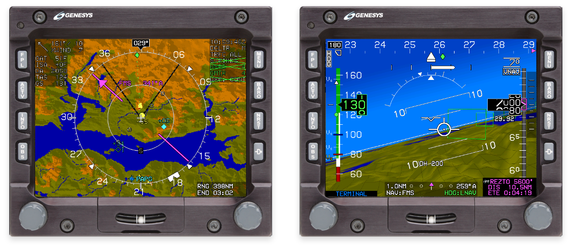
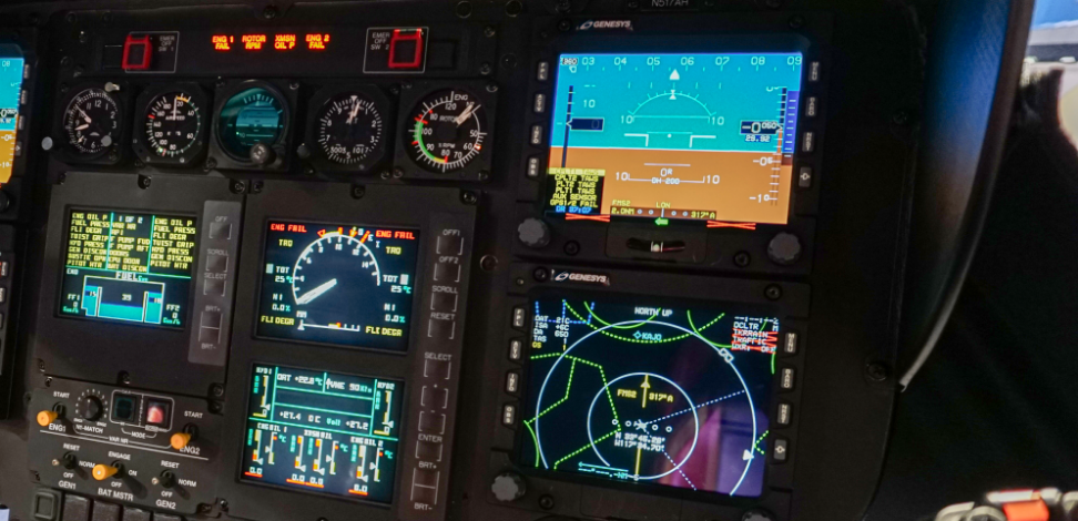
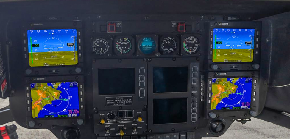
Genesys’ IDU-450 EFIS suites feature a variety of PFD and MFD formats that can be configured to show flight instruments, moving map, HSI, flight planner, traffic, terrain, weather radar, and datalink. The IDU-450s also feature a build-in Flight Management System and integrated Class-A TAWS (Terrain Awareness and Warning System) for enhanced safety and workload management. The Genesys avionics suite boasts an open architecture for elegant interfacing with a variety of special-mission equipment.
Features
The 3D Synthetic Vision EFIS from Genesys Aerosystems enhances safety, reduces pilot workload, increases flexibility, and lowers costs of operation. The Level A certified IDU-450 smart display EFIS utilizes ADAHRS and GPS SBAS data for precision aircraft operation including RNP and LPV approaches, and Genesys’ patented OASIS® (Open Architecture System Integration Symbology) to display engine information and CAS messages.
Spend less on maintenance and replacement parts while experiencing greater uptime and higher mission completion rates with our modern avionics suite. Built-in support/interfaces for FLIR, DF, and Datalink provide a low-cost path to future upgrades. The MIL-STD qualified, and NVG-compatible Genesys avionics offer robust and flexible performance for demanding environments and are available for both OEM new production and modernization of select aircraft.
The IDU-450 comes standard with:
- 3D Synthetic Vision (SVS)
- Highway-In-The-Sky (HITS) Navigation
- Geo-Referenced Hover Vector
- Terrain Alerting and Warning System (TAWS & HTAWS)
- Graphical Flight Management System (FMS)
- Digital Flight Recorder (DFR)
- Night Vision Compatibility
- MIL-STD Qualification
- And More
For Support with an existing installation, please click here
Genesys Aerosystems EFIS Environmental Stress Tests
Designed For Harsh Environments
Genesys EFIS displays are designed to operate in harsh operational environments in order to ensure product reliability and dependability. These include high and low temperature, vibration, lightning strike, HIRF, altitude, sand and dust, water-proofness, fluids susceptibility, salt and fog, and other environmental condition tests.
Image Gallery
Need a Quote?
Speak with a Genesys Expert
Contact Us